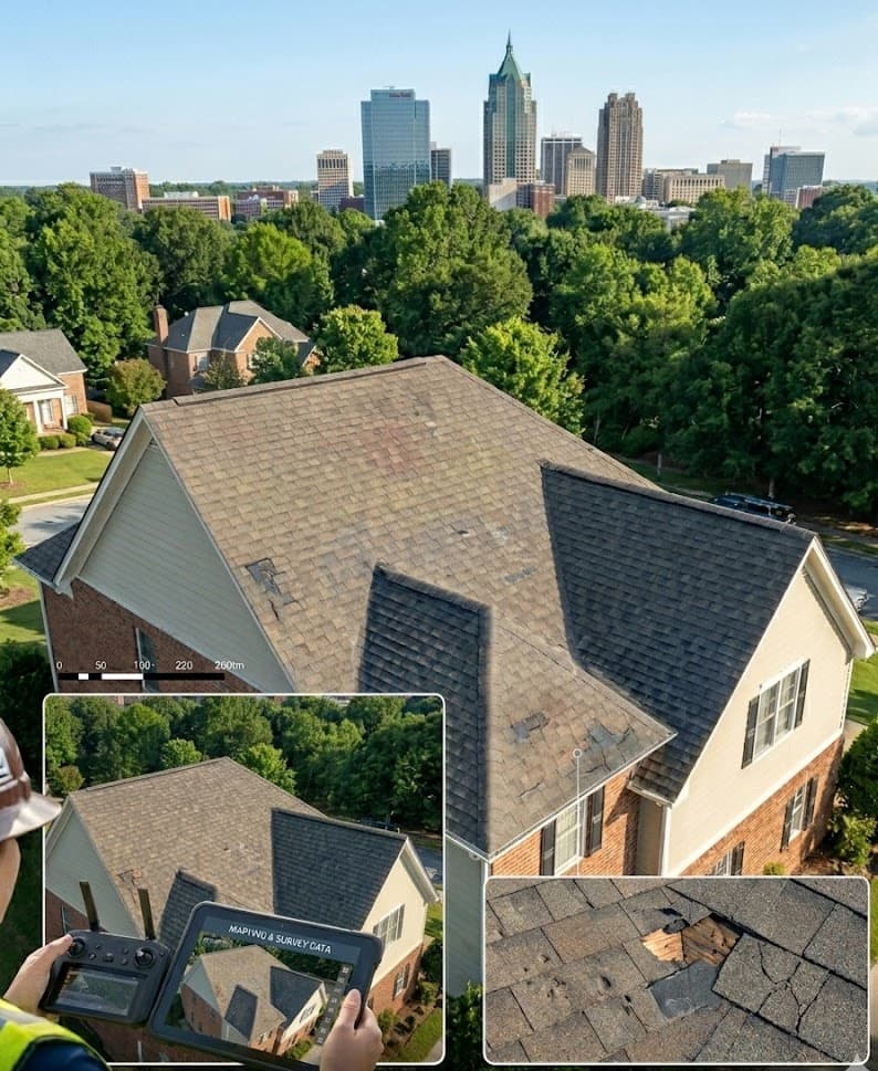
Inspection-grade aerial imagery.
High-resolution visual data for roofs, solar arrays, façades, and infrastructure — calibrated, geo-tagged, and handed off in your inspectors' format. We capture; you assess.
Why aerial is now the default — not the alternative.
- 01
No one on the roof, in the bucket truck, or on the catwalk. The fall-risk math is uncontroversial — drone inspections eliminate the leading cause of construction fatalities.
- 02
Façade and roof captures finish in hours, not days of scaffolding or rope-access labour. Insurance and OSHA paperwork shrinks accordingly.
- 03
Same-waypoint repeat flights make cycle-to-cycle comparison straightforward — you see what changed, not what looks different.
- 04
Thermal and RGB captured in one pass — half the field time, twice the data.
- 05
Calibrated, geo-tagged stills hold up as dispute-grade documentation when claims show up later.
The capability mix.
Most inspection imagery briefs use one or two of these — sometimes all of them. Open the service for the long-form.
- Inspection imagery
Calibrated stills, defect-spot grid, RGB + thermal.
Service detail → - Mapping & survey data
Geo-referenced ortho when scale demands it.
Service detail →
What lands in your inbox.
- Calibrated, geo-tagged stills
- Defect-spot grid layout
- Thermal / RGB capture
- Hand-off in your inspector's format
- Dispute-grade documentation when needed
- Inspectors and engineering firms
- Solar developers and O&M teams
- Roofing and façade contractors
- Infrastructure asset owners
The kind of project we’d expect.
- 01Utility-scale solar field baseline survey
- 02Pre-construction façade documentation
- 03Post-storm roof assessment for a managed portfolio
- 04Telecom tower or bridge visual inspection
A clearer view for inspection imagery.
Same-week scheduling across the Triangle. Statewide and nationwide for film, commercial, and large-scale survey work.