01
Aerial photography
Editorial-grade stills for marketing, listings, brand, and editorial use.
Typical deliverables
- 20–40 colour-graded stills
- RAW + JPEG + WebP
- Twilight & golden-hour add-on
- Licensed for commercial use

Four core capabilities. One studio. Pick one or combine — every brief is shaped to the way your team will actually use the deliverables.
Editorial-grade stills for marketing, listings, brand, and editorial use.
Cinematic 4K and 6K capture, smooth motion, considered framing.
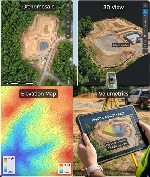
Orthomosaics, 3D models, elevation maps and volumetrics — geo-referenced.
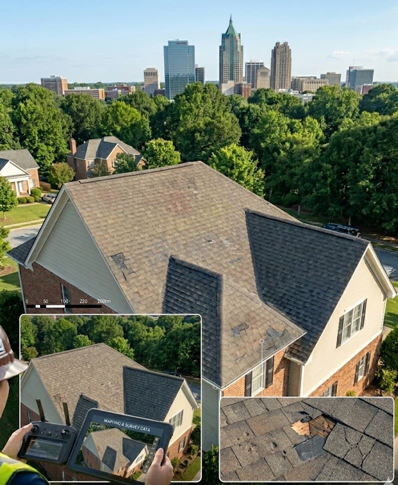
High-resolution visual data of roofs, solar arrays, façades and infrastructure.
Different teams, different uses for the same well-made image.
Listings, twilight, lifestyle. Calibrated for MLS, brochure, and social.
Open sector→Monthly progress capture, ortho, volumetrics, and as-built data.
Open sector→Cinematic aerial work integrated with your DP, editor, and colourist.
Open sector→Quiet, considered context — never intrusive. Family-first delivery.
Open sector→Visual data captured to your inspectors’ specification. We capture; you assess.
Open sector→Scroll-ready stills and short-form video that earn a second look.
Open sector→Tell us what you’re building or capturing. We’ll propose the simplest service mix that delivers what you need.